


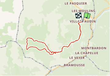
refuge de Furfande à partir de villardgaudin

franquen
User

Length
19.7 km

Max alt
2295 m

Uphill gradient
1084 m
Km-Effort
34 km

Min alt
1591 m

Downhill gradient
1086 m
Boucle
Yes
Creation date :
2021-06-15 06:38:35.139
Updated on :
2021-06-15 16:20:25.393
7h57
Difficulty : Very difficult

FREE GPS app for hiking
 SityTrail
IGN / Geographical institutes
SityTrail Plus
The world is yours!
About
Trail Walking of 19.7 km to be discovered at Provence-Alpes-Côte d'Azur, Hautes-Alpes, Arvieux. This trail is proposed by franquen.
Positioning
Country:
France
Region :
Provence-Alpes-Côte d'Azur
Department/Province :
Hautes-Alpes
Municipality :
Arvieux
Location:
Unknown
Start:(Dec)
Start:(UTM)
322477 ; 4956984 (32T) N.
Comments