


13 juin

BertrandHubert
User
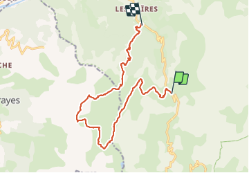

Length
16.8 km

Max alt
2592 m

Uphill gradient
849 m
Km-Effort
29 km

Min alt
1540 m

Downhill gradient
1212 m
Boucle
No
Creation date :
2021-06-13 06:05:06.365
Updated on :
2021-06-16 13:46:46.651
5h31
Difficulty : Very difficult

FREE GPS app for hiking
 SityTrail
IGN / Geographical institutes
SityTrail Plus
The world is yours!
About
Trail Walking of 16.8 km to be discovered at Provence-Alpes-Côte d'Azur, Alpes-de-Haute-Provence, Jausiers. This trail is proposed by BertrandHubert.
Positioning
Country:
France
Region :
Provence-Alpes-Côte d'Azur
Department/Province :
Alpes-de-Haute-Provence
Municipality :
Jausiers
Location:
Unknown
Start:(Dec)
Start:(UTM)
323514 ; 4915272 (32T) N.
Comments