


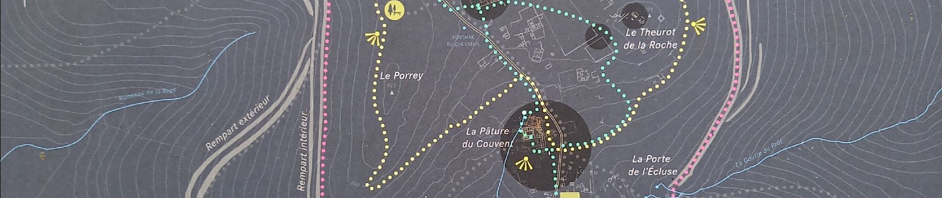
Saint léger sous Beuvray oppidum de Bibracte page 150

grasgilbert
User
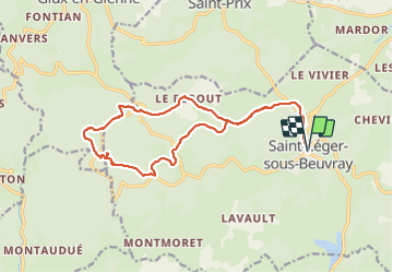

Length
17.6 km

Max alt
816 m

Uphill gradient
542 m
Km-Effort
25 km

Min alt
380 m

Downhill gradient
542 m
Boucle
Yes
Creation date :
2021-06-17 07:50:22.289
Updated on :
2021-08-05 14:57:18.919
6h42
Difficulty : Difficult

FREE GPS app for hiking
 SityTrail
IGN / Geographical institutes
SityTrail Plus
The world is yours!
About
Trail Walking of 17.6 km to be discovered at Bourgogne-Franche-Comté, Saône-et-Loire, Saint-Léger-sous-Beuvray. This trail is proposed by grasgilbert.
Photos


Positioning
Country:
France
Region :
Bourgogne-Franche-Comté
Department/Province :
Saône-et-Loire
Municipality :
Saint-Léger-sous-Beuvray
Location:
Unknown
Start:(Dec)
Start:(UTM)
583825 ; 5197209 (31T) N.
Comments
très bien
très bien