


6666666666 14:44:14

UDGI54
User
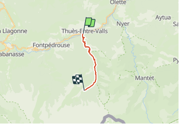

Length
11.9 km

Max alt
1838 m

Uphill gradient
1253 m
Km-Effort
25 km

Min alt
844 m

Downhill gradient
270 m
Boucle
No
Creation date :
2021-06-20 19:21:52.133
Updated on :
2021-06-20 19:40:26.835

FREE GPS app for hiking
 SityTrail
IGN / Geographical institutes
SityTrail Plus
The world is yours!
About
Trail of 11.9 km to be discovered at Occitania, Pyrénées-Orientales, Thuès-Entre-Valls. This trail is proposed by UDGI54.
Positioning
Country:
France
Region :
Occitania
Department/Province :
Pyrénées-Orientales
Municipality :
Thuès-Entre-Valls
Location:
Unknown
Start:(Dec)
Start:(UTM)
436066 ; 4708096 (31T) N.
Comments