


69Champagne_bois-210621

adye
User
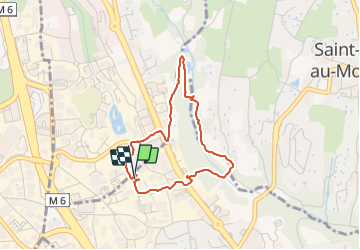

Length
3.3 km

Max alt
304 m

Uphill gradient
52 m
Km-Effort
4 km

Min alt
265 m

Downhill gradient
54 m
Boucle
Yes
Creation date :
2021-06-21 11:15:14.647
Updated on :
2021-06-21 21:34:12.435
48m
Difficulty : Very easy

FREE GPS app for hiking
 SityTrail
IGN / Geographical institutes
SityTrail Plus
The world is yours!
About
Trail Walking of 3.3 km to be discovered at Auvergne-Rhône-Alpes, Métropole de Lyon, Champagne-au-Mont-d'Or. This trail is proposed by adye.
Description
Sous les bois
Positioning
Country:
France
Region :
Auvergne-Rhône-Alpes
Department/Province :
Métropole de Lyon
Municipality :
Champagne-au-Mont-d'Or
Location:
Unknown
Start:(Dec)
Start:(UTM)
638170 ; 5073867 (31T) N.
Comments