


Le Bouchet St Nicolas

PhilippeC54
User

Length
65 km

Max alt
1221 m

Uphill gradient
1183 m
Km-Effort
81 km

Min alt
819 m

Downhill gradient
1186 m
Boucle
Yes
Creation date :
2021-06-23 07:41:16.791
Updated on :
2021-06-23 14:21:08.259
3h35
Difficulty : Medium

FREE GPS app for hiking
 SityTrail
IGN / Geographical institutes
SityTrail Plus
The world is yours!
About
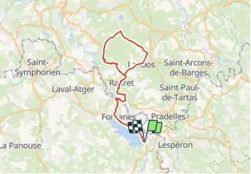
Trail Road bike of 65 km to be discovered at Occitania, Lozère, Langogne. This trail is proposed by PhilippeC54.
Positioning
Country:
France
Region :
Occitania
Department/Province :
Lozère
Municipality :
Langogne
Location:
Unknown
Start:(Dec)
Start:(UTM)
566440 ; 4953695 (31T) N.
Comments