


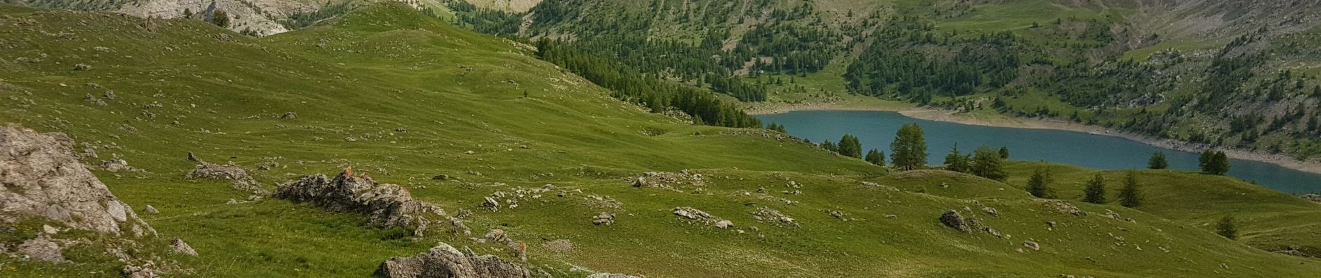
Petite tour lac d'Allos

PEBREJOSIANE
User
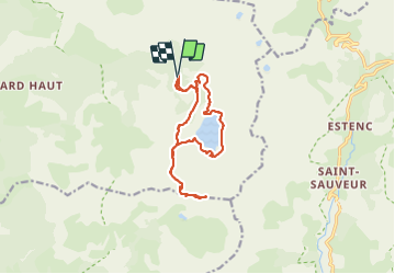

Length
14.5 km

Max alt
2667 m

Uphill gradient
636 m
Km-Effort
23 km

Min alt
2112 m

Downhill gradient
635 m
Boucle
Yes
Creation date :
2021-06-23 08:01:43.289
Updated on :
2021-06-24 08:27:21.816
5h28
Difficulty : Medium

FREE GPS app for hiking
 SityTrail
IGN / Geographical institutes
SityTrail Plus
The world is yours!
About
Trail Walking of 14.5 km to be discovered at Provence-Alpes-Côte d'Azur, Alpes-de-Haute-Provence, Allos. This trail is proposed by PEBREJOSIANE.
Photos


Positioning
Country:
France
Region :
Provence-Alpes-Côte d'Azur
Department/Province :
Alpes-de-Haute-Provence
Municipality :
Allos
Location:
Unknown
Start:(Dec)
Start:(UTM)
316231 ; 4901836 (32T) N.
Comments