


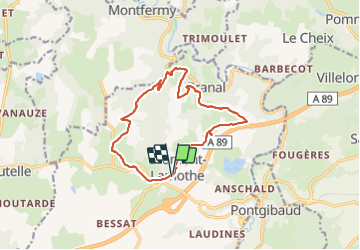
Le Puy de Moufle

Gegetop
User

Length
13.9 km

Max alt
802 m

Uphill gradient
343 m
Km-Effort
18.5 km

Min alt
628 m

Downhill gradient
342 m
Boucle
Yes
Creation date :
2021-06-25 08:52:52.76
Updated on :
2021-06-25 12:58:43.35
3h50
Difficulty : Medium
3h27
Difficulty : Medium

FREE GPS app for hiking
 SityTrail
IGN / Geographical institutes
SityTrail Plus
The world is yours!
About
Trail Walking of 13.9 km to be discovered at Auvergne-Rhône-Alpes, Puy-de-Dôme, Bromont-Lamothe. This trail is proposed by Gegetop.
Description
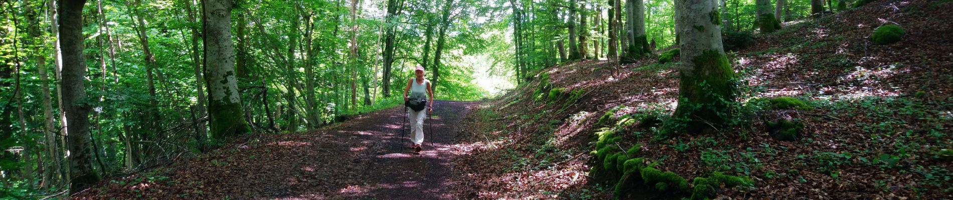
Très jolie balade à travers bois et campagnes.
Le point de vue depuis le Puy de Moufle est de toute beauté.
Photos


Positioning
Country:
France
Region :
Auvergne-Rhône-Alpes
Department/Province :
Puy-de-Dôme
Municipality :
Bromont-Lamothe
Location:
Unknown
Start:(Dec)
Start:(UTM)
486005 ; 5076389 (31T) N.
Comments
Sympa mais différent du tracé balisé en jaune