Rausa (Outrelouxhe) - Les Communes (Ombret-Rawsa)

tatous
User
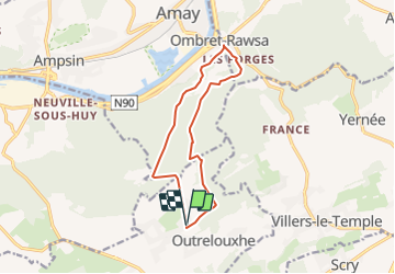

Length
10.8 km

Max alt
248 m

Uphill gradient
221 m
Km-Effort
13.8 km

Min alt
91 m

Downhill gradient
219 m
Boucle
Yes
Creation date :
2021-06-26 15:38:20.77
Updated on :
2021-06-26 16:02:13.989
2h58
Difficulty : Difficult

FREE GPS app for hiking
 SityTrail
IGN / Geographical institutes
SityTrail Plus
The world is yours!
About
Trail Walking of 10.8 km to be discovered at Wallonia, Liège, Modave. This trail is proposed by tatous.
Positioning
Country:
Belgium
Region :
Wallonia
Department/Province :
Liège
Municipality :
Modave
Location:
Unknown
Start:(Dec)
Start:(UTM)
664996 ; 5597616 (31U) N.
Comments