


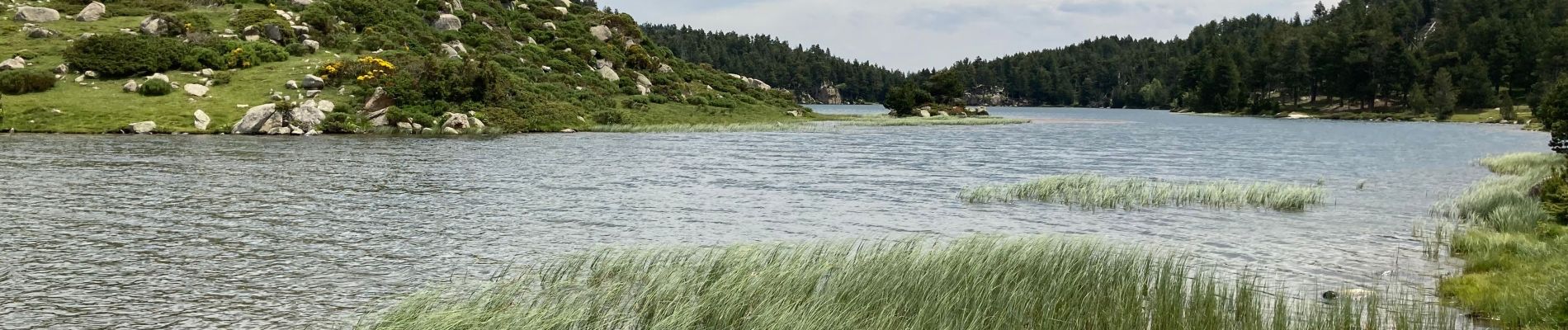
Lacs d’en bas

fb30
User
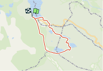

Length
7.1 km

Max alt
2043 m

Uphill gradient
173 m
Km-Effort
9.4 km

Min alt
1943 m

Downhill gradient
178 m
Boucle
Yes
Creation date :
2021-06-27 07:47:12.0
Updated on :
2021-06-27 12:09:10.002
2h47
Difficulty : Easy

FREE GPS app for hiking
 SityTrail
IGN / Geographical institutes
SityTrail Plus
The world is yours!
About
Trail Walking of 7.1 km to be discovered at Occitania, Pyrénées-Orientales, Angoustrine-Villeneuve-des-Escaldes. This trail is proposed by fb30.
Photos

Positioning
Country:
France
Region :
Occitania
Department/Province :
Pyrénées-Orientales
Municipality :
Angoustrine-Villeneuve-des-Escaldes
Location:
Unknown
Start:(Dec)
Start:(UTM)
417671 ; 4712487 (31T) N.
Comments