


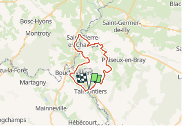
Talmontiers - Mont Ste Hélène

philberard95
User

Length
21 km

Max alt
226 m

Uphill gradient
393 m
Km-Effort
27 km

Min alt
73 m

Downhill gradient
394 m
Boucle
Yes
Creation date :
2021-06-30 15:38:08.499
Updated on :
2021-06-30 15:39:10.538
6h03
Difficulty : Very difficult

FREE GPS app for hiking
 SityTrail
IGN / Geographical institutes
SityTrail Plus
The world is yours!
About
Trail Walking of 21 km to be discovered at Hauts-de-France, Oise, Talmontiers. This trail is proposed by philberard95.
Positioning
Country:
France
Region :
Hauts-de-France
Department/Province :
Oise
Municipality :
Talmontiers
Location:
Unknown
Start:(Dec)
Start:(UTM)
408254 ; 5471428 (31U) N.
Comments