


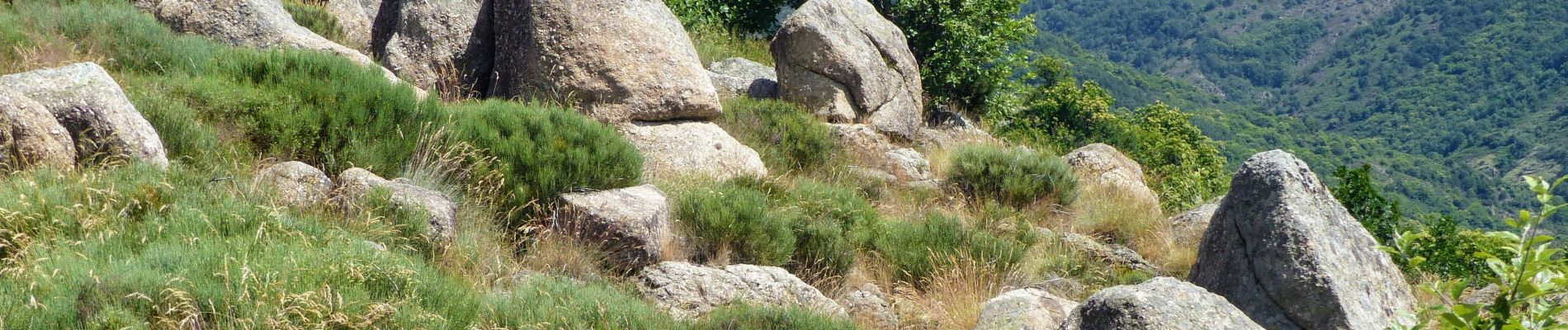
Pont du Mas - Boules de Gargantua

thonyc
User GUIDE
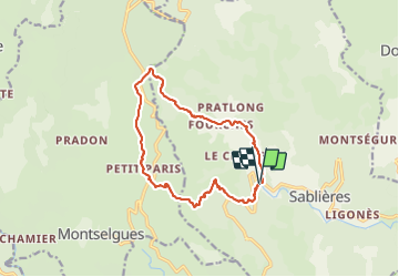

Length
13.9 km

Max alt
1145 m

Uphill gradient
782 m
Km-Effort
24 km

Min alt
448 m

Downhill gradient
787 m
Boucle
Yes
Creation date :
2021-06-30 08:18:47.413
Updated on :
2021-07-02 16:18:54.934
5h30
Difficulty : Difficult

FREE GPS app for hiking
 SityTrail
IGN / Geographical institutes
SityTrail Plus
The world is yours!
About
Trail Walking of 13.9 km to be discovered at Auvergne-Rhône-Alpes, Ardèche, Sablières. This trail is proposed by thonyc.
Photos


Positioning
Country:
France
Region :
Auvergne-Rhône-Alpes
Department/Province :
Ardèche
Municipality :
Sablières
Location:
Unknown
Start:(Dec)
Start:(UTM)
583875 ; 4931803 (31T) N.
Comments