


Levada

Alfredy
User GUIDE

Length
14.6 km

Max alt
1167 m

Uphill gradient
1413 m
Km-Effort
34 km

Min alt
774 m

Downhill gradient
1430 m
Boucle
Yes
Creation date :
2021-07-10 08:57:36.0
Updated on :
2021-07-10 13:05:45.276
4h08
Difficulty : Medium

FREE GPS app for hiking
 SityTrail
IGN / Geographical institutes
SityTrail Plus
The world is yours!
About
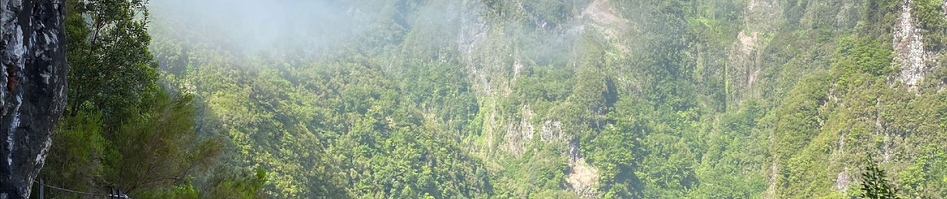
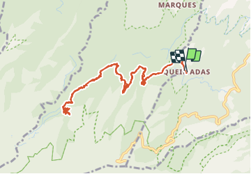
Trail Walking of 14.6 km to be discovered at Madeira, Unknown, Santana. This trail is proposed by Alfredy.
Description
Levada
Photos


25 photos in total. Please click on a photo to see them all in the gallery.
Positioning
Country:
Portugal
Region :
Madeira
Department/Province :
Unknown
Municipality :
Santana
Location:
Unknown
Start:(Dec)
Start:(UTM)
321443 ; 3628936 (28S) N.
Comments