


venosc par le sapey

kikkko
User
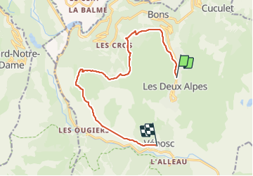

Length
13 km

Max alt
1716 m

Uphill gradient
338 m
Km-Effort
19.6 km

Min alt
983 m

Downhill gradient
971 m
Boucle
No
Creation date :
2021-07-13 09:25:05.646
Updated on :
2021-07-13 15:01:47.99
3h07
Difficulty : Medium

FREE GPS app for hiking
 SityTrail
IGN / Geographical institutes
SityTrail Plus
The world is yours!
About
Trail Walking of 13 km to be discovered at Auvergne-Rhône-Alpes, Isère, Les Deux Alpes. This trail is proposed by kikkko.
Description
Tour du pied moutet, quelques passages aériens
Positioning
Country:
France
Region :
Auvergne-Rhône-Alpes
Department/Province :
Isère
Municipality :
Les Deux Alpes
Location:
Unknown
Start:(Dec)
Start:(UTM)
273426 ; 4988416 (32T) N.
Comments