


Bonneval andagne bessan

nicogex
User
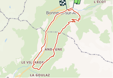

Length
18 km

Max alt
2499 m

Uphill gradient
861 m
Km-Effort
30 km

Min alt
1733 m

Downhill gradient
878 m
Boucle
No
Creation date :
2021-07-15 20:39:50.262
Updated on :
2021-07-15 20:41:25.849
6h42
Difficulty : Very difficult

FREE GPS app for hiking
 SityTrail
IGN / Geographical institutes
SityTrail Plus
The world is yours!
About
Trail Walking of 18 km to be discovered at Auvergne-Rhône-Alpes, Savoy, Bonneval-sur-Arc. This trail is proposed by nicogex.
Description
Ballade de demain
Positioning
Country:
France
Region :
Auvergne-Rhône-Alpes
Department/Province :
Savoy
Municipality :
Bonneval-sur-Arc
Location:
Unknown
Start:(Dec)
Start:(UTM)
347952 ; 5026464 (32T) N.
Comments