


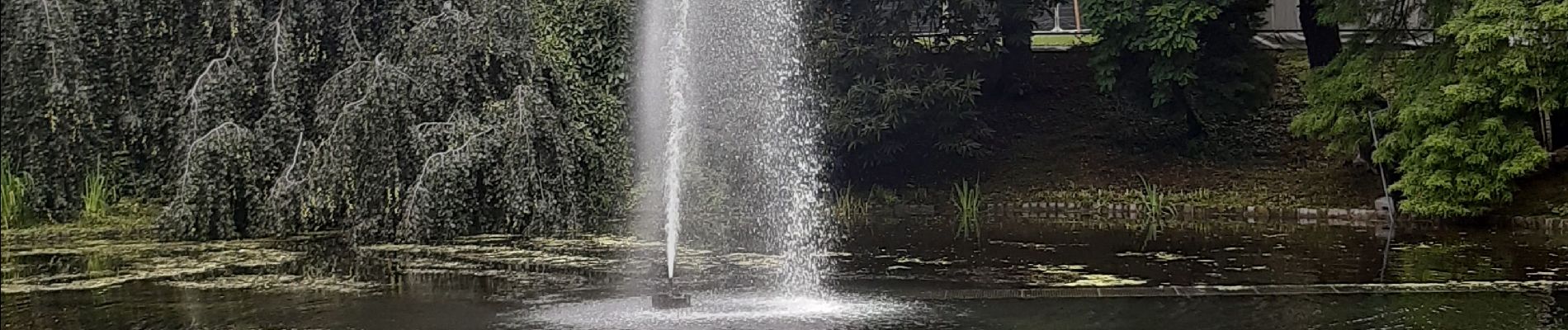
liege etat des eaux inondations 14 15 16 juillet 21

stef789
User GUIDE
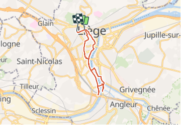

Length
9.6 km

Max alt
105 m

Uphill gradient
122 m
Km-Effort
11.3 km

Min alt
49 m

Downhill gradient
140 m
Boucle
No
Creation date :
2021-07-16 07:51:13.607
Updated on :
2021-07-16 10:05:18.165
2h11
Difficulty : Very easy

FREE GPS app for hiking
 SityTrail
IGN / Geographical institutes
SityTrail Plus
The world is yours!
About
Trail Walking of 9.6 km to be discovered at Wallonia, Liège, Liège. This trail is proposed by stef789.
Photos


26 photos in total. Please click on a photo to see them all in the gallery.
Positioning
Country:
Belgium
Region :
Wallonia
Department/Province :
Liège
Municipality :
Liège
Location:
Glain
Start:(Dec)
Start:(UTM)
681198 ; 5613461 (31U) N.
Comments