


Promenade sur les caches de de pikluc1315 dans les Monts d'Eraines

yannick-p
User
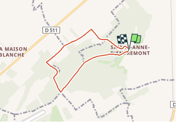

Length
5.9 km

Max alt
139 m

Uphill gradient
109 m
Km-Effort
7.4 km

Min alt
69 m

Downhill gradient
112 m
Boucle
Yes
Creation date :
2021-07-16 21:16:22.681
Updated on :
2021-07-16 21:21:22.147
3h00
Difficulty : Easy

FREE GPS app for hiking
 SityTrail
IGN / Geographical institutes
SityTrail Plus
The world is yours!
About
Trail Geocaching of 5.9 km to be discovered at Normandy, Calvados, Bernières-d'Ailly. This trail is proposed by yannick-p.
Positioning
Country:
France
Region :
Normandy
Department/Province :
Calvados
Municipality :
Bernières-d'Ailly
Location:
Unknown
Start:(Dec)
Start:(UTM)
711635 ; 5425183 (30U) N.
Comments