


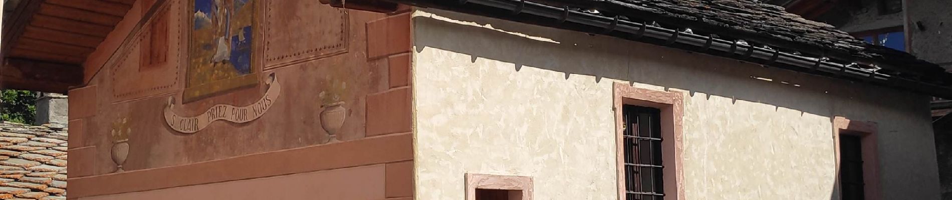
Bramans

gdela
User
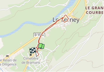

Length
1.6 km

Max alt
1241 m

Uphill gradient
25 m
Km-Effort
1.9 km

Min alt
1219 m

Downhill gradient
21 m
Boucle
Yes
Creation date :
2021-07-17 08:19:00.222
Updated on :
2021-07-17 08:57:08.397
26m
Difficulty : Easy

FREE GPS app for hiking
 SityTrail
IGN / Geographical institutes
SityTrail Plus
The world is yours!
About
Trail Walking of 1.6 km to be discovered at Auvergne-Rhône-Alpes, Savoy, Val-Cenis. This trail is proposed by gdela.
Photos


Positioning
Country:
France
Region :
Auvergne-Rhône-Alpes
Department/Province :
Savoy
Municipality :
Val-Cenis
Location:
Bramans
Start:(Dec)
Start:(UTM)
325810 ; 5010741 (32T) N.
Comments