gorges de Ballandaz

whisper73
User
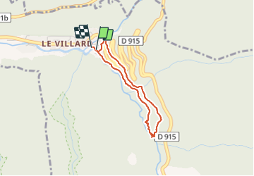


1h01
Difficulty : Easy

FREE GPS app for hiking
 SityTrail
IGN / Geographical institutes
SityTrail Plus
The world is yours!
About
Trail Walking of 2.8 km to be discovered at Auvergne-Rhône-Alpes, Savoy, Planay. This trail is proposed by whisper73.
Description
Petite rando mais spectaculaire. Avec les gorges de Ballandaz sur le Doron de Pralognan.
On longe tout d'abord une vieille canalisation hydraulique, puis on arrive sur la gorge avec une avancée métallique en caillebotis juste au dessus de l'eau. Un peu de frisson. On admire le travail de l'eau sur les roches.
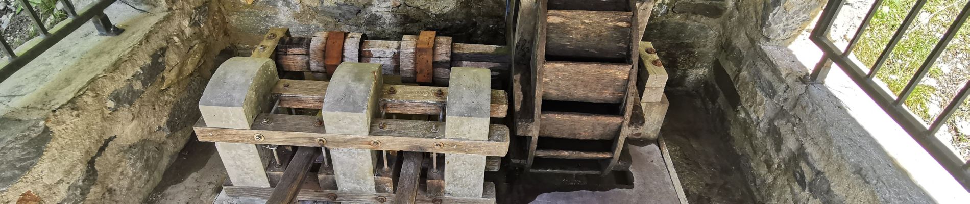
On redescend par une large piste ou l'on peut voir une maquette de roue hydraulique. On peut finir la rando par la visite du musée Hydraulica à Villard.
Une rando à faire en période chaude.
Photos


Positioning
Comments