


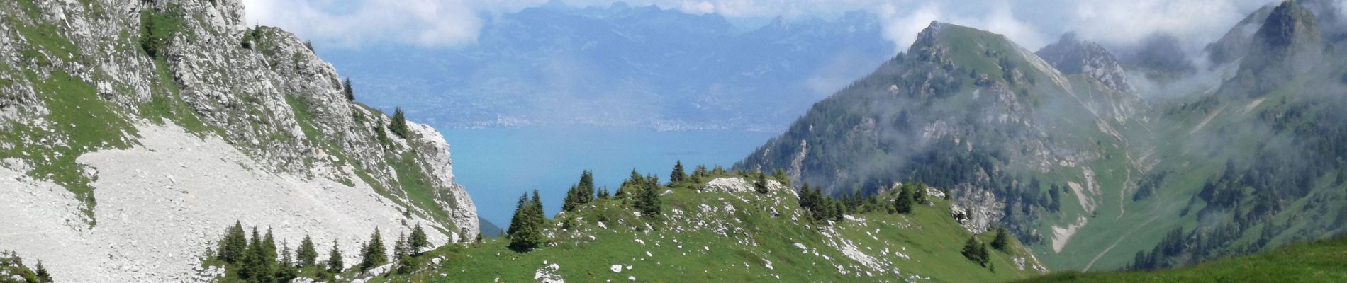
LAC DARBON CHAROUSSE

Jean-Paulchoux
User
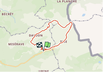

Length
14.9 km

Max alt
2066 m

Uphill gradient
1046 m
Km-Effort
29 km

Min alt
1346 m

Downhill gradient
1044 m
Boucle
Yes
Creation date :
2021-07-18 07:22:12.69
Updated on :
2021-07-18 20:05:30.418
9h49
Difficulty : Difficult

FREE GPS app for hiking
 SityTrail
IGN / Geographical institutes
SityTrail Plus
The world is yours!
About
Trail Walking of 14.9 km to be discovered at Auvergne-Rhône-Alpes, Upper Savoy, Vacheresse. This trail is proposed by Jean-Paulchoux.
Photos


Positioning
Country:
France
Region :
Auvergne-Rhône-Alpes
Department/Province :
Upper Savoy
Municipality :
Vacheresse
Location:
Unknown
Start:(Dec)
Start:(UTM)
326204 ; 5132447 (32T) N.
Comments
