


2021-07-20_22h10m53_39-Oberhaslach-Cascade_Nideck

geranimo
User
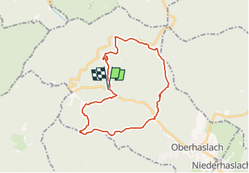

Length
14.3 km

Max alt
644 m

Uphill gradient
681 m
Km-Effort
23 km

Min alt
298 m

Downhill gradient
678 m
Boucle
Yes
Creation date :
2021-07-20 20:10:53.348
Updated on :
2023-03-06 20:06:38.034
39m
Difficulty : Medium

FREE GPS app for hiking
 SityTrail
IGN / Geographical institutes
SityTrail Plus
The world is yours!
About
Trail Walking of 14.3 km to be discovered at Grand Est, Bas-Rhin, Oberhaslach. This trail is proposed by geranimo.
Positioning
Country:
France
Region :
Grand Est
Department/Province :
Bas-Rhin
Municipality :
Oberhaslach
Location:
Unknown
Start:(Dec)
Start:(UTM)
373498 ; 5381002 (32U) N.
Comments