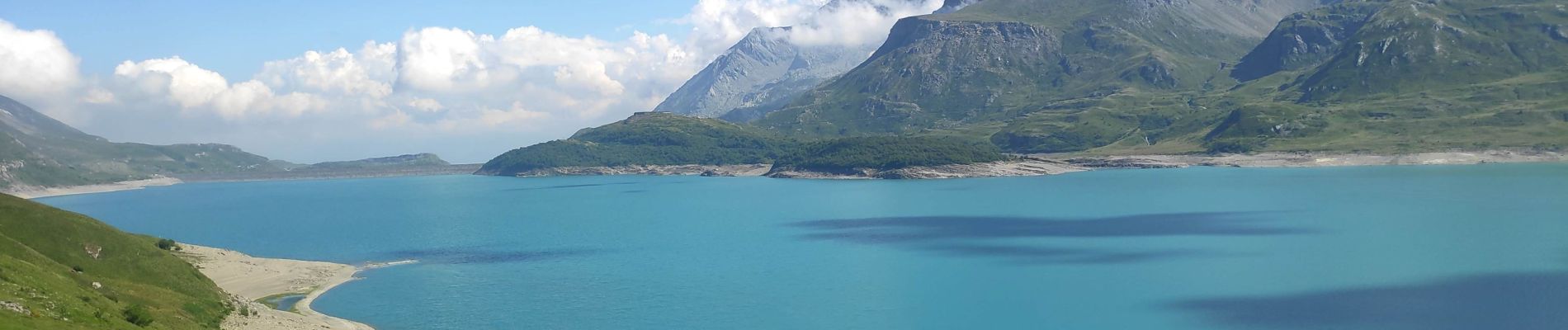
tour du lac du Mont Cenis

gdela
User
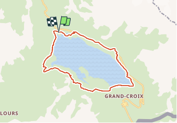

Length
16.2 km

Max alt
2107 m

Uphill gradient
458 m
Km-Effort
22 km

Min alt
1961 m

Downhill gradient
466 m
Boucle
Yes
Creation date :
2021-07-20 08:49:25.108
Updated on :
2021-07-21 09:10:00.579
4h38
Difficulty : Difficult

FREE GPS app for hiking
 SityTrail
IGN / Geographical institutes
SityTrail Plus
The world is yours!
About
Trail Walking of 16.2 km to be discovered at Auvergne-Rhône-Alpes, Savoy, Val-Cenis. This trail is proposed by gdela.
Photos


22 photos in total. Please click on a photo to see them all in the gallery.
Positioning
Country:
France
Region :
Auvergne-Rhône-Alpes
Department/Province :
Savoy
Municipality :
Val-Cenis
Location:
Lanslebourg-Mont-Cenis
Start:(Dec)
Start:(UTM)
335973 ; 5013014 (32T) N.
Comments