


Aucelon

raygautier
User
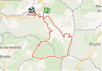

Length
21 km

Max alt
1595 m

Uphill gradient
926 m
Km-Effort
34 km

Min alt
666 m

Downhill gradient
1171 m
Boucle
No
Creation date :
2021-07-22 06:26:08.0
Updated on :
2021-07-22 15:35:28.292
8h11
Difficulty : Very difficult

FREE GPS app for hiking
 SityTrail
IGN / Geographical institutes
SityTrail Plus
The world is yours!
About
Trail Walking of 21 km to be discovered at Auvergne-Rhône-Alpes, Drôme, Aucelon. This trail is proposed by raygautier.
Positioning
Country:
France
Region :
Auvergne-Rhône-Alpes
Department/Province :
Drôme
Municipality :
Aucelon
Location:
Unknown
Start:(Dec)
Start:(UTM)
687008 ; 4943693 (31T) N.
Comments