


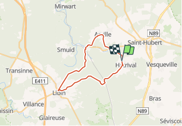

13.9 km | 17.6 km-effort


User


FREE GPS app for hiking
 SityTrail
IGN / Geographical institutes
SityTrail World
The world is yours!
Trail Electric bike of 21 km to be discovered at Wallonia, Luxembourg, Saint-Hubert. This trail is proposed by MJehaes.
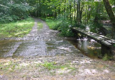
De sérieuses montées et descentes ! Tout un trajet sur une nationale. Pistes cyclables en état très moyen: graviers .
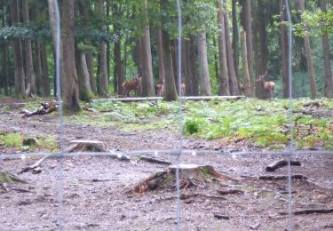
quelques beaux paysages mais pas inoubliables !

Walking

Walking

Walking

Walking

Walking

Walking

Walking
Walking
Walking