


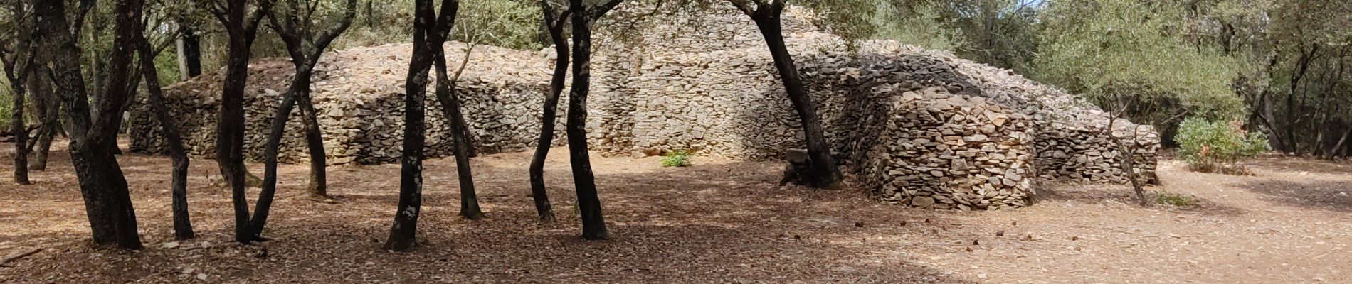
Nages les capitelle

guyzinz
User
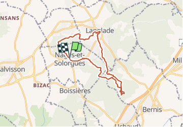

Length
14.8 km

Max alt
178 m

Uphill gradient
297 m
Km-Effort
18.7 km

Min alt
60 m

Downhill gradient
297 m
Boucle
Yes
Creation date :
2021-07-25 06:24:52.365
Updated on :
2021-07-25 12:08:24.739
5h10
Difficulty : Easy

FREE GPS app for hiking
 SityTrail
IGN / Geographical institutes
SityTrail Plus
The world is yours!
About
Trail Walking of 14.8 km to be discovered at Occitania, Gard, Nages-et-Solorgues. This trail is proposed by guyzinz.
Photos


Positioning
Country:
France
Region :
Occitania
Department/Province :
Gard
Municipality :
Nages-et-Solorgues
Location:
Unknown
Start:(Dec)
Start:(UTM)
598997 ; 4849357 (31T) N.
Comments