


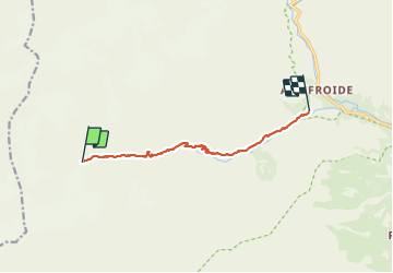
retour bas du glacier du Sélé au camping d'Ailefroide

fredtruc27
User

Length
8.1 km

Max alt
2588 m

Uphill gradient
7 m
Km-Effort
11.7 km

Min alt
1518 m

Downhill gradient
1073 m
Boucle
No
Creation date :
2021-07-26 11:09:13.637
Updated on :
2021-07-26 15:14:29.6
2h58
Difficulty : Medium

FREE GPS app for hiking
 SityTrail
IGN / Geographical institutes
SityTrail Plus
The world is yours!
About
Trail Walking of 8.1 km to be discovered at Provence-Alpes-Côte d'Azur, Hautes-Alpes, Vallouise-Pelvoux. This trail is proposed by fredtruc27.
Positioning
Country:
France
Region :
Provence-Alpes-Côte d'Azur
Department/Province :
Hautes-Alpes
Municipality :
Vallouise-Pelvoux
Location:
Pelvoux
Start:(Dec)
Start:(UTM)
292425 ; 4972001 (32T) N.
Comments