Trail Walking Lavigerie - Col de Serre - Pas de Peyrol - Puy Mary - Brèche de Rolland - Photo

Col de Serre - Pas de Peyrol - Puy Mary - Brèche de Rolland

© OpenStreetMap contributors
Length
Length
11.7 km
Max alt
Max alt
1767 m
Uphill gradient
Uphill gradient
594 m
Km-Effort
Km-Effort  
19.6 km
Min alt
Min alt
1331 m
Downhill gradient
Downhill gradient
578 m
Boucle
Boucle
Yes
Creation date :
2021-07-26 08:31:17.096
Updated on :
2021-08-01 11:30:23.662

(1 Reviews)

Walking
Walking
5h37
Difficulty : Difficult

Scan this QR Code to open this trail in the SityTrail application

FREE GPS app for hiking

Logo SityTrail SityTrail

IGN / Geographical institutes

Download SityTrail from the App Store Download SityTrail from Google Play

Logo SityTrail SityTrail World

The world is yours!

Download SityTrail from the App Store Download SityTrail from Google Play Download SityTrail on Huawei AppGallery

About

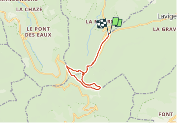
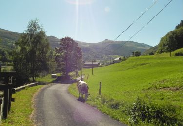
Trail Walking of 11.7 km to be discovered at Auvergne-Rhône-Alpes, Cantal, Lavigerie. This trail is proposed by VacheKiri67.

Description

Faite le 26/07/2021. Au départ du parking au Col de Serre
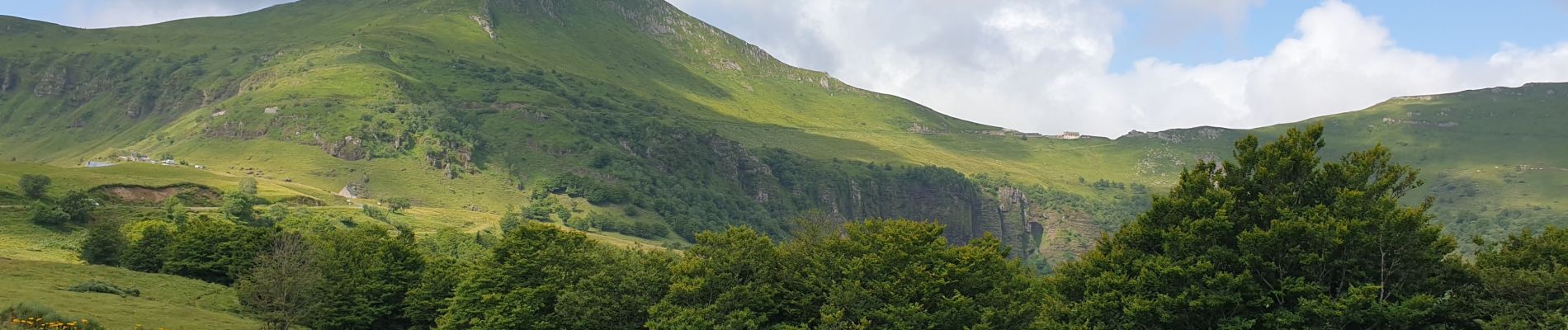
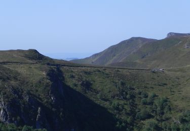
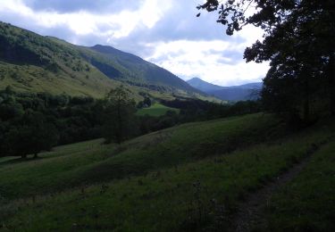
Chaussures de montagne indispensables.
La montée vers le Puy Mary se fait par un chemin aménagé mais raide. La difficile descente se fait par un sentier raide déconseillé aux personnes sujettes au vertige et le passage de la Brèche de Rolland nécessite la pause de mains.
Mais quel panorama !

Elevation profile

Photos

60 photos in total. Please click on a photo to see them all in the gallery.

Positioning

Country:
France
Region :
Auvergne-Rhône-Alpes
Department/Province :
Cantal
Municipality :
Lavigerie
Location:
Unknown
Start:(UTM)
476596 ; 4997479 (31T) N.

Comments

Please log in to post a review or rate the element


Trails nearby

Trail Walking Lavigerie - Le Puy de Peyre Arse depuis la Gravière - Photo
Walking
tracegps

Walking

Difficult
(2)
Lavigerie, Auvergne-Rhône-Alpes, Cantal, France
11.2 km | 21 km-effort
4h 0min
Yes
Trail Walking Laveissière - Les crêtes du Cantal - Le Lioran - Photo
Walking
tracegps

Walking

Difficult
(4)
Laveissière, Auvergne-Rhône-Alpes, Cantal, France
28 km | 51 km-effort
7h 30min
Yes
Trail Walking Laveissière - le Peyre Arse - Le Lioran - Photo
Walking
tracegps

Walking

Difficult
(1)
Laveissière, Auvergne-Rhône-Alpes, Cantal, France
11.2 km | 19.4 km-effort
4h 0min
No
Trail Walking Laveissière - Lioran 2023-08-18 Col de Rombière Col du Pertus A/R - Photo
Walking
marionneau

Walking

Easy
(1)
Laveissière, Auvergne-Rhône-Alpes, Cantal, France
12.5 km | 18.8 km-effort
4h 14min
Yes
Trail Walking Laveissière - Lioran 2023-08-11 Col du Pertus - Photo
Walking
marionneau

Walking

Medium
(1)
Laveissière, Auvergne-Rhône-Alpes, Cantal, France
17.3 km | 25 km-effort
2h 57min
Yes
Trail Walking Laveissière - Lioran 2023-08-09 Puy de Seycheuse - Photo
Walking
marionneau

Walking

Very difficult
(1)
Laveissière, Auvergne-Rhône-Alpes, Cantal, France
13.9 km | 23 km-effort
5h 20min
Yes
Trail On foot Le Claux - Les Chamois - Photo
On foot
PRO

On foot

Medium
Le Claux, Auvergne-Rhône-Alpes, Cantal, France
17.3 km | 25 km-effort
5h 36min
No
Trail On foot Lavigerie - La Vallée de l'Impradine - Photo
On foot
PRO

On foot

Easy
Lavigerie, Auvergne-Rhône-Alpes, Cantal, France
5.5 km | 7.6 km-effort
1h 44min
Yes
Trail On foot Le Falgoux - Sentier de la cascade du Biaguin - Photo
On foot
PRO

On foot

Easy
Le Falgoux, Auvergne-Rhône-Alpes, Cantal, France
3.8 km | 5.5 km-effort
1h 14min
Yes


Close
My subscriptions