


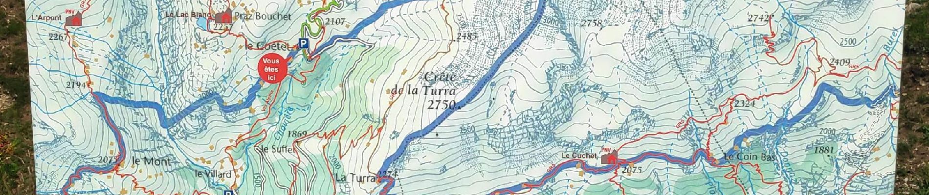
boucle du lac Blanc

gdela
User
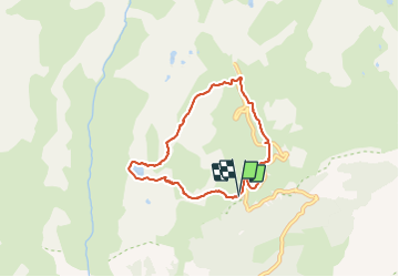

Length
6.3 km

Max alt
2388 m

Uphill gradient
350 m
Km-Effort
10.9 km

Min alt
2051 m

Downhill gradient
345 m
Boucle
Yes
Creation date :
2021-07-27 08:41:00.591
Updated on :
2021-07-27 15:53:20.274
2h33
Difficulty : Medium

FREE GPS app for hiking
 SityTrail
IGN / Geographical institutes
SityTrail Plus
The world is yours!
About
Trail Walking of 6.3 km to be discovered at Auvergne-Rhône-Alpes, Savoy, Val-Cenis. This trail is proposed by gdela.
Photos


Positioning
Country:
France
Region :
Auvergne-Rhône-Alpes
Department/Province :
Savoy
Municipality :
Val-Cenis
Location:
Termignon
Start:(Dec)
Start:(UTM)
329877 ; 5020241 (32T) N.
Comments