


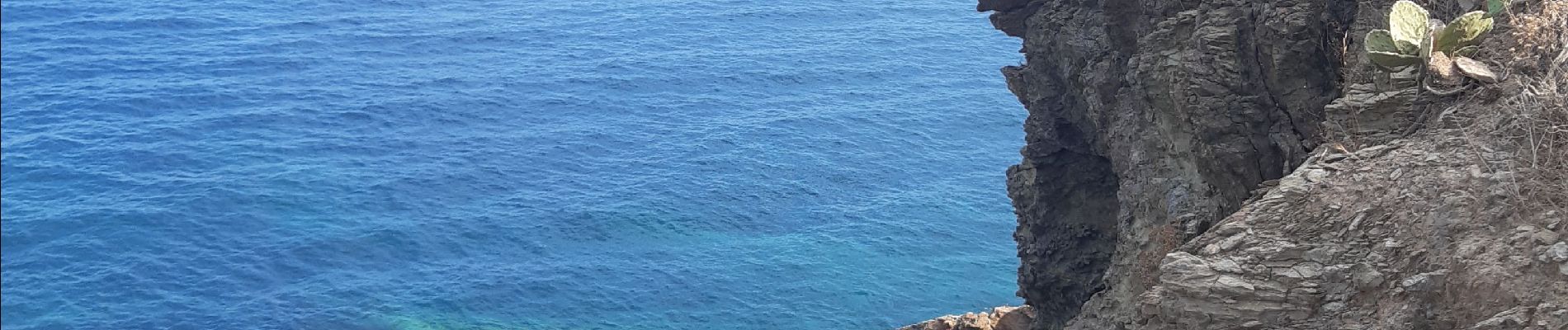
paulille . cap bear . paulille

stef789
User GUIDE
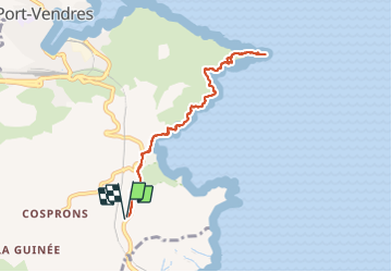

Length
8.5 km

Max alt
55 m

Uphill gradient
241 m
Km-Effort
11.7 km

Min alt
0 m

Downhill gradient
238 m
Boucle
Yes
Creation date :
2021-07-27 13:34:32.544
Updated on :
2021-07-27 17:08:26.333
3h12
Difficulty : Medium

FREE GPS app for hiking
 SityTrail
IGN / Geographical institutes
SityTrail Plus
The world is yours!
About
Trail Walking of 8.5 km to be discovered at Occitania, Pyrénées-Orientales, Port-Vendres. This trail is proposed by stef789.
Photos


Positioning
Country:
France
Region :
Occitania
Department/Province :
Pyrénées-Orientales
Municipality :
Port-Vendres
Location:
Unknown
Start:(Dec)
Start:(UTM)
509753 ; 4704929 (31T) N.
Comments