


ferme de l'Etache

gdela
User
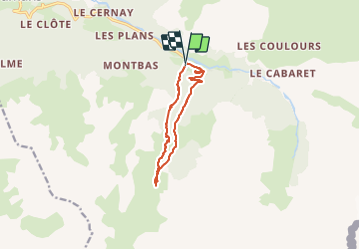

Length
10.8 km

Max alt
2027 m

Uphill gradient
415 m
Km-Effort
16.4 km

Min alt
1663 m

Downhill gradient
422 m
Boucle
Yes
Creation date :
2021-07-28 11:59:28.26
Updated on :
2021-08-17 10:05:33.145
3h24
Difficulty : Medium

FREE GPS app for hiking
 SityTrail
IGN / Geographical institutes
SityTrail Plus
The world is yours!
About
Trail Walking of 10.8 km to be discovered at Auvergne-Rhône-Alpes, Savoy, Val-Cenis. This trail is proposed by gdela.
Photos


Positioning
Country:
France
Region :
Auvergne-Rhône-Alpes
Department/Province :
Savoy
Municipality :
Val-Cenis
Location:
Bramans
Start:(Dec)
Start:(UTM)
329947 ; 5008194 (32T) N.
Comments