


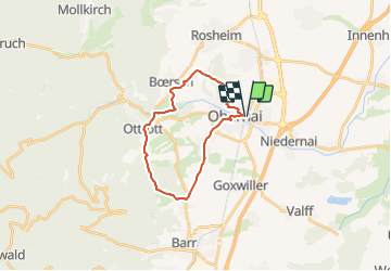
2021-07-28_20h35m31_29-Obernai-Piémont-Ste-Odile

geranimo
User

Length
20 km

Max alt
366 m

Uphill gradient
415 m
Km-Effort
26 km

Min alt
181 m

Downhill gradient
415 m
Boucle
Yes
Creation date :
2021-07-28 18:35:31.719
Updated on :
2021-07-28 18:39:31.698
29m
Difficulty : Medium

FREE GPS app for hiking
 SityTrail
IGN / Geographical institutes
SityTrail Plus
The world is yours!
About
Trail Walking of 20 km to be discovered at Grand Est, Bas-Rhin, Obernai. This trail is proposed by geranimo.
Positioning
Country:
France
Region :
Grand Est
Department/Province :
Bas-Rhin
Municipality :
Obernai
Location:
Unknown
Start:(Dec)
Start:(UTM)
388294 ; 5368789 (32U) N.
Comments