


todtmoos-Wher

benjaminvh
User
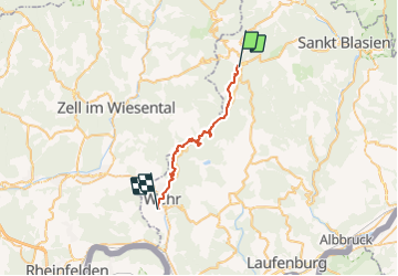

Length
25 km

Max alt
912 m

Uphill gradient
664 m
Km-Effort
36 km

Min alt
347 m

Downhill gradient
1128 m
Boucle
No
Creation date :
2021-08-01 13:25:32.157
Updated on :
2021-08-01 13:26:26.535
8h07
Difficulty : Very difficult

FREE GPS app for hiking
 SityTrail
IGN / Geographical institutes
SityTrail Plus
The world is yours!
About
Trail Walking of 25 km to be discovered at Baden-Württemberg, Landkreis Waldshut, Todtmoos. This trail is proposed by benjaminvh.
Description
derniere etape foret noire
Positioning
Country:
Germany
Region :
Baden-Württemberg
Department/Province :
Landkreis Waldshut
Municipality :
Todtmoos
Location:
Unknown
Start:(Dec)
Start:(UTM)
425084 ; 5287830 (32T) N.
Comments