


tour mezenc

Robertplessier
User
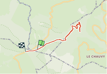

Length
7.9 km

Max alt
1579 m

Uphill gradient
168 m
Km-Effort
10.2 km

Min alt
1426 m

Downhill gradient
186 m
Boucle
No
Creation date :
2021-08-02 12:29:06.945
Updated on :
2021-08-02 14:40:32.847
2h01
Difficulty : Very easy

FREE GPS app for hiking
 SityTrail
IGN / Geographical institutes
SityTrail Plus
The world is yours!
About
Trail Trail of 7.9 km to be discovered at Auvergne-Rhône-Alpes, Haute-Loire, Chaudeyrolles. This trail is proposed by Robertplessier.
Positioning
Country:
France
Region :
Auvergne-Rhône-Alpes
Department/Province :
Haute-Loire
Municipality :
Chaudeyrolles
Location:
Unknown
Start:(Dec)
Start:(UTM)
593345 ; 4974354 (31T) N.
Comments