


vers le veygalier à frayssinet de fourgues

labarone
User
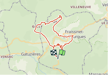

Length
18 km

Max alt
1161 m

Uphill gradient
583 m
Km-Effort
26 km

Min alt
730 m

Downhill gradient
583 m
Boucle
Yes
Creation date :
2021-08-03 08:01:25.049
Updated on :
2021-08-03 14:57:33.153
5h05
Difficulty : Medium

FREE GPS app for hiking
 SityTrail
IGN / Geographical institutes
SityTrail Plus
The world is yours!
About
Trail Walking of 18 km to be discovered at Occitania, Lozère, Fraissinet-de-Fourques. This trail is proposed by labarone.
Description
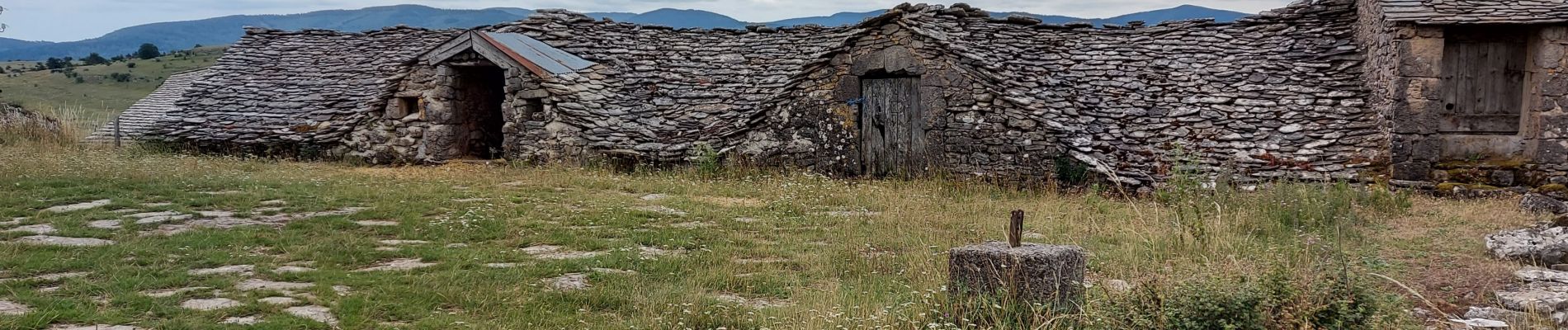
une belle montée le matin.Repas au veygalier puis passage dans le chaos de Nîmes
belle rando
Photos


Positioning
Country:
France
Region :
Occitania
Department/Province :
Lozère
Municipality :
Fraissinet-de-Fourques
Location:
Unknown
Start:(Dec)
Start:(UTM)
541568 ; 4893622 (31T) N.
Comments