


la quoirelle

jbo1
User
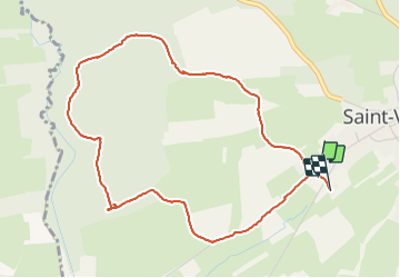

Length
4.6 km

Max alt
390 m

Uphill gradient
71 m
Km-Effort
5.6 km

Min alt
346 m

Downhill gradient
70 m
Boucle
Yes
Creation date :
2021-08-03 14:21:44.095
Updated on :
2021-08-03 15:47:00.597
1h31
Difficulty : Easy

FREE GPS app for hiking
 SityTrail
IGN / Geographical institutes
SityTrail Plus
The world is yours!
About
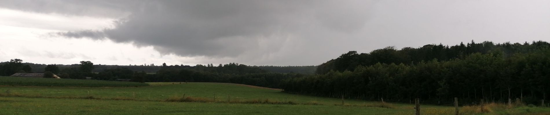
Trail Walking of 4.6 km to be discovered at Wallonia, Luxembourg, Tintigny. This trail is proposed by jbo1.
Photos


Positioning
Country:
Belgium
Region :
Wallonia
Department/Province :
Luxembourg
Municipality :
Tintigny
Location:
Unknown
Start:(Dec)
Start:(UTM)
678139 ; 5505351 (31U) N.
Comments