


mon petit tour st jean cap ferrat

stef789
User GUIDE

Length
11.6 km

Max alt
86 m

Uphill gradient
268 m
Km-Effort
15.2 km

Min alt
-1 m

Downhill gradient
271 m
Boucle
No
Creation date :
2021-08-03 11:56:46.615
Updated on :
2021-08-03 18:19:45.736
6h04
Difficulty : Difficult

FREE GPS app for hiking
 SityTrail
IGN / Geographical institutes
SityTrail Plus
The world is yours!
About
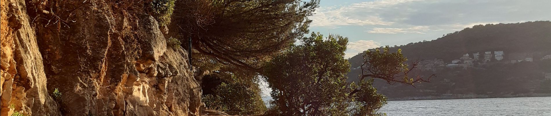
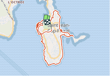
Trail Walking of 11.6 km to be discovered at Provence-Alpes-Côte d'Azur, Maritime Alps, Saint-Jean-Cap-Ferrat. This trail is proposed by stef789.
Photos


Positioning
Country:
France
Region :
Provence-Alpes-Côte d'Azur
Department/Province :
Maritime Alps
Municipality :
Saint-Jean-Cap-Ferrat
Location:
Unknown
Start:(Dec)
Start:(UTM)
364915 ; 4838968 (32T) N.
Comments