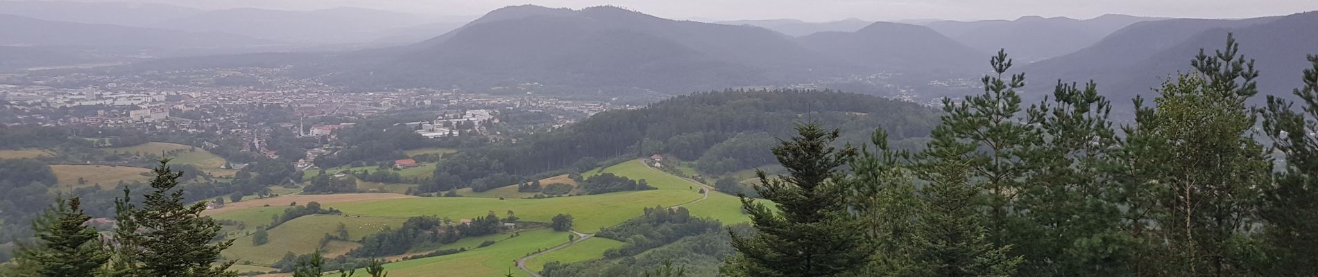
Balade autour du Col de la Crenée

Jullido1
User
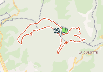

Length
11.4 km

Max alt
661 m

Uphill gradient
414 m
Km-Effort
17 km

Min alt
422 m

Downhill gradient
413 m
Boucle
Yes
Creation date :
2021-08-07 07:28:40.794
Updated on :
2021-08-07 11:18:13.425
3h48
Difficulty : Easy

FREE GPS app for hiking
 SityTrail
IGN / Geographical institutes
SityTrail Plus
The world is yours!
About
Trail Walking of 11.4 km to be discovered at Grand Est, Vosges, Saint-Dié-des-Vosges. This trail is proposed by Jullido1.
Description
Balade facile autour du Col de la Crenée
Photos


Positioning
Country:
France
Region :
Grand Est
Department/Province :
Vosges
Municipality :
Saint-Dié-des-Vosges
Location:
Unknown
Start:(Dec)
Start:(UTM)
348322 ; 5354367 (32U) N.
Comments