


Lo

raygautier
User

Length
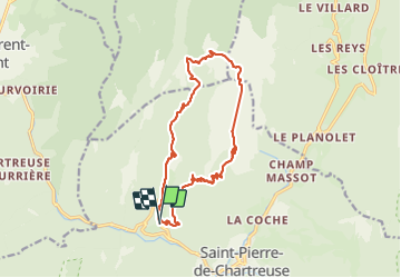
16 km

Max alt
2012 m

Uphill gradient
1305 m
Km-Effort
33 km

Min alt
859 m

Downhill gradient
1305 m
Boucle
Yes
Creation date :
2021-08-08 06:24:00.0
Updated on :
2021-08-09 21:05:44.381
7h28
Difficulty : Very difficult

FREE GPS app for hiking
 SityTrail
IGN / Geographical institutes
SityTrail Plus
The world is yours!
About
Trail Walking of 16 km to be discovered at Auvergne-Rhône-Alpes, Isère, Saint-Pierre-de-Chartreuse. This trail is proposed by raygautier.
Positioning
Country:
France
Region :
Auvergne-Rhône-Alpes
Department/Province :
Isère
Municipality :
Saint-Pierre-de-Chartreuse
Location:
Unknown
Start:(Dec)
Start:(UTM)
718511 ; 5025717 (31T) N.
Comments