


Sources VIENNE

Dupuybadonniere
User
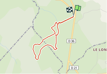

Length
3.7 km

Max alt
907 m

Uphill gradient
118 m
Km-Effort
5.3 km

Min alt
854 m

Downhill gradient
119 m
Boucle
Yes
Creation date :
2021-08-09 11:50:02.909
Updated on :
2021-08-09 16:45:30.499
1h17
Difficulty : Medium

FREE GPS app for hiking
 SityTrail
IGN / Geographical institutes
SityTrail Plus
The world is yours!
About
Trail Walking of 3.7 km to be discovered at New Aquitaine, Corrèze, Saint-Setiers. This trail is proposed by Dupuybadonniere.
Positioning
Country:
France
Region :
New Aquitaine
Department/Province :
Corrèze
Municipality :
Saint-Setiers
Location:
Unknown
Start:(Dec)
Start:(UTM)
429613 ; 5057546 (31T) N.
Comments