


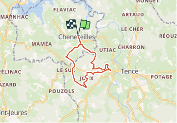
Chenereilles, le château de Joux

Gegetop
User

Length
12.3 km

Max alt
948 m

Uphill gradient
319 m
Km-Effort
16.6 km

Min alt
848 m

Downhill gradient
318 m
Boucle
Yes
Creation date :
2021-08-10 09:30:56.109
Updated on :
2021-08-10 13:24:22.772
3h05
Difficulty : Medium

FREE GPS app for hiking
 SityTrail
IGN / Geographical institutes
SityTrail Plus
The world is yours!
About
Trail Walking of 12.3 km to be discovered at Auvergne-Rhône-Alpes, Haute-Loire, Chenereilles. This trail is proposed by Gegetop.
Description
Vous marcherez à travers les immenses sapinières en alternance avec les vertes prairies dans un paysage vallonné et bucolique 😊
Photos


Positioning
Country:
France
Region :
Auvergne-Rhône-Alpes
Department/Province :
Haute-Loire
Municipality :
Chenereilles
Location:
Unknown
Start:(Dec)
Start:(UTM)
598543 ; 4998563 (31T) N.
Comments