


col côte 2239m

bellouelo46
User
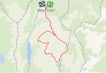

Length
19.1 km

Max alt
2321 m

Uphill gradient
1404 m
Km-Effort
38 km

Min alt
939 m

Downhill gradient
1413 m
Boucle
Yes
Creation date :
2021-08-08 06:54:01.086
Updated on :
2021-08-11 05:05:36.453
7h46
Difficulty : Difficult

FREE GPS app for hiking
 SityTrail
IGN / Geographical institutes
SityTrail Plus
The world is yours!
About
Trail Walking of 19.1 km to be discovered at Occitania, Ariège, Siguer. This trail is proposed by bellouelo46.
Description
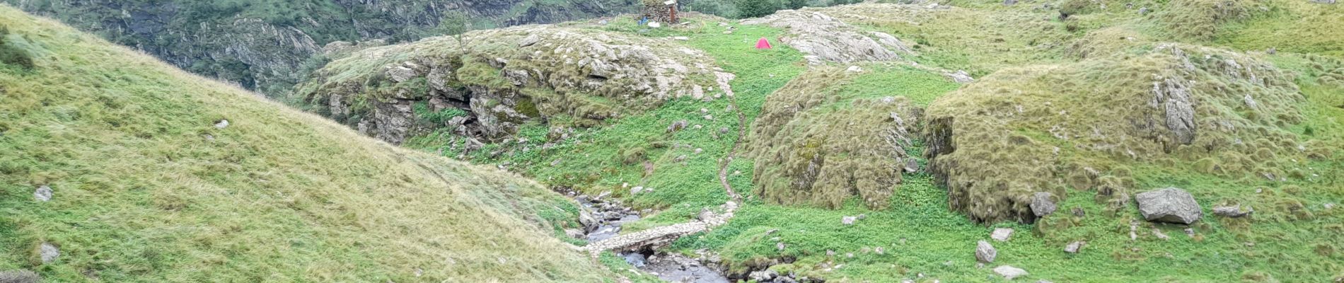
belle randonnée assez exigeante mais sympa après le lac des redouneilles sur le haut sentier pas évident sans gps mais sinon pas de difficulté mis a part le dénivelé
Photos


Positioning
Country:
France
Region :
Occitania
Department/Province :
Ariège
Municipality :
Siguer
Location:
Unknown
Start:(Dec)
Start:(UTM)
381277 ; 4731852 (31T) N.
Comments