


col de vars via l écuelle retour via refuge napoléon et font bonne

stef789
User GUIDE
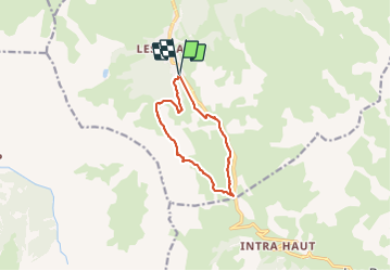

Length
9.9 km

Max alt
2428 m

Uphill gradient
530 m
Km-Effort
17 km

Min alt
1927 m

Downhill gradient
533 m
Boucle
Yes
Creation date :
2021-08-11 10:25:57.985
Updated on :
2021-08-11 19:02:25.871
5h08
Difficulty : Medium

FREE GPS app for hiking
 SityTrail
IGN / Geographical institutes
SityTrail Plus
The world is yours!
About
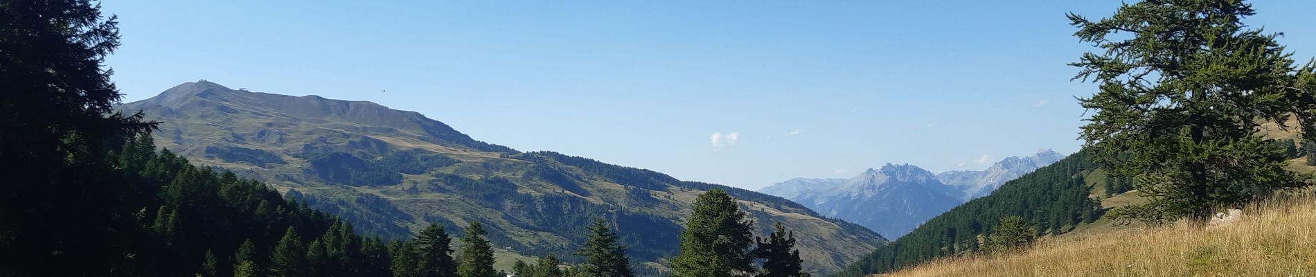
Trail Walking of 9.9 km to be discovered at Provence-Alpes-Côte d'Azur, Hautes-Alpes, Vars. This trail is proposed by stef789.
Photos


23 photos in total. Please click on a photo to see them all in the gallery.
Positioning
Country:
France
Region :
Provence-Alpes-Côte d'Azur
Department/Province :
Hautes-Alpes
Municipality :
Vars
Location:
Unknown
Start:(Dec)
Start:(UTM)
316191 ; 4937391 (32T) N.
Comments