


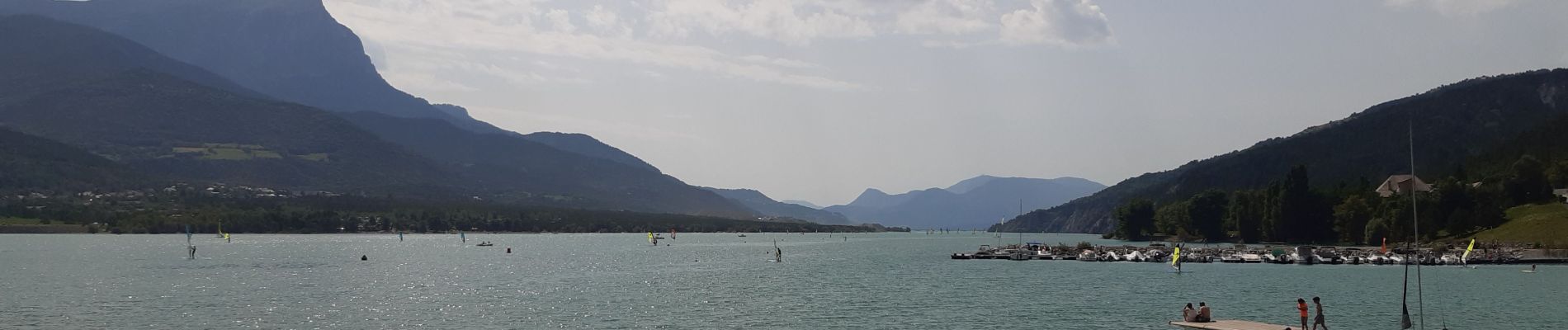
tour d Embrun et son plan d eau

stef789
User GUIDE
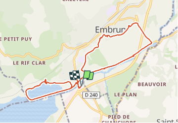

Length
11.5 km

Max alt
874 m

Uphill gradient
182 m
Km-Effort
14 km

Min alt
776 m

Downhill gradient
181 m
Boucle
Yes
Creation date :
2021-08-12 09:58:01.951
Updated on :
2021-08-12 15:24:58.686
2h54
Difficulty : Very easy

FREE GPS app for hiking
 SityTrail
IGN / Geographical institutes
SityTrail Plus
The world is yours!
About
Trail Walking of 11.5 km to be discovered at Provence-Alpes-Côte d'Azur, Hautes-Alpes, Baratier. This trail is proposed by stef789.
Photos


Positioning
Country:
France
Region :
Provence-Alpes-Côte d'Azur
Department/Province :
Hautes-Alpes
Municipality :
Baratier
Location:
Unknown
Start:(Dec)
Start:(UTM)
300302 ; 4936027 (32T) N.
Comments