


Boucle : Lac du crozet depuis parking de la Pra

manumax
User
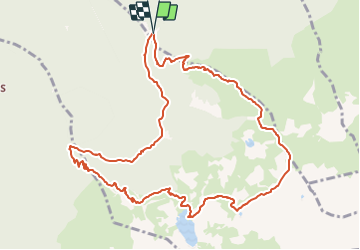

Length
12.4 km

Max alt
2368 m

Uphill gradient
982 m
Km-Effort
25 km

Min alt
1433 m

Downhill gradient
983 m
Boucle
Yes
Creation date :
2021-08-12 20:16:57.062
Updated on :
2021-08-23 20:22:05.407
5h47
Difficulty : Very difficult

FREE GPS app for hiking
 SityTrail
IGN / Geographical institutes
SityTrail Plus
The world is yours!
About
Trail Walking of 12.4 km to be discovered at Auvergne-Rhône-Alpes, Isère, Saint-Mury-Monteymond. This trail is proposed by manumax.
Description
Randonnée à faire, une variante de la boucle du lac du crozet
Positioning
Country:
France
Region :
Auvergne-Rhône-Alpes
Department/Province :
Isère
Municipality :
Saint-Mury-Monteymond
Location:
Unknown
Start:(Dec)
Start:(UTM)
730155 ; 5008660 (31T) N.
Comments