


Voreppe - Rocher de Bellevue

Sigmut
User
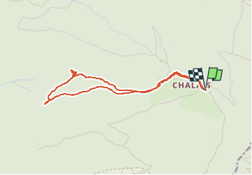

Length
4.1 km

Max alt
1076 m

Uphill gradient
208 m
Km-Effort
6.9 km

Min alt
923 m

Downhill gradient
209 m
Boucle
Yes
Creation date :
2021-08-13 09:36:09.052
Updated on :
2023-01-21 23:08:07.599
1h23
Difficulty : Easy

FREE GPS app for hiking
 SityTrail
IGN / Geographical institutes
SityTrail Plus
The world is yours!
About
Trail Walking of 4.1 km to be discovered at Auvergne-Rhône-Alpes, Isère, Voreppe. This trail is proposed by Sigmut.
Description
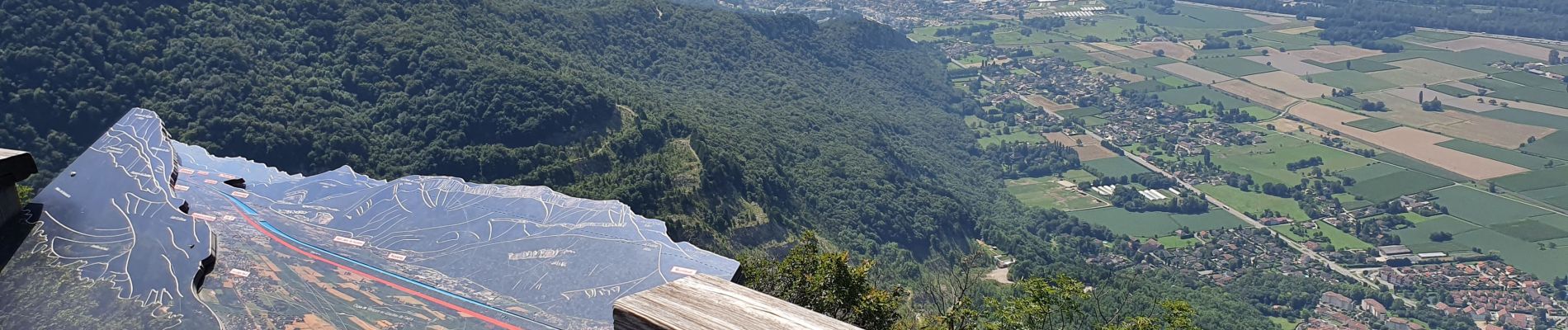
Marche paisible avec vues magnifiques sur la vallée de Grenoble.
Photos


Positioning
Country:
France
Region :
Auvergne-Rhône-Alpes
Department/Province :
Isère
Municipality :
Voreppe
Location:
Unknown
Start:(Dec)
Start:(UTM)
709935 ; 5018900 (31T) N.
Comments