


le canyon des erges

raygautier
User
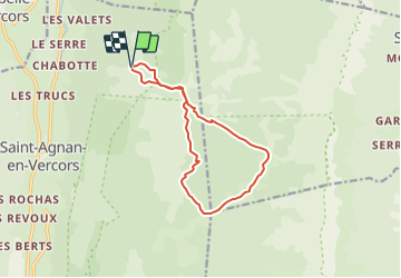

Length
12.1 km

Max alt
1622 m

Uphill gradient
483 m
Km-Effort
18.5 km

Min alt
1283 m

Downhill gradient
480 m
Boucle
Yes
Creation date :
2021-08-14 19:34:45.59
Updated on :
2021-08-14 19:35:25.786
4h12
Difficulty : Difficult

FREE GPS app for hiking
 SityTrail
IGN / Geographical institutes
SityTrail Plus
The world is yours!
About
Trail Walking of 12.1 km to be discovered at Auvergne-Rhône-Alpes, Drôme, Saint-Agnan-en-Vercors. This trail is proposed by raygautier.
Description
jolie rando
Positioning
Country:
France
Region :
Auvergne-Rhône-Alpes
Department/Province :
Drôme
Municipality :
Saint-Agnan-en-Vercors
Location:
Unknown
Start:(Dec)
Start:(UTM)
693980 ; 4980882 (31T) N.
Comments