


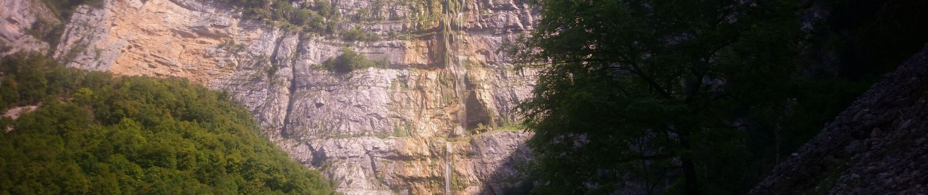
grotte du Bournillon

okfred26
User
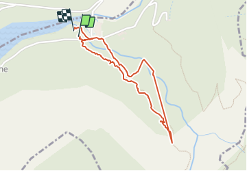

Length
2 km

Max alt
471 m

Uphill gradient
148 m
Km-Effort
4 km

Min alt
311 m

Downhill gradient
153 m
Boucle
Yes
Creation date :
2021-08-14 13:37:56.083
Updated on :
2021-08-15 11:55:46.749
1h21
Difficulty : Easy

FREE GPS app for hiking
 SityTrail
IGN / Geographical institutes
SityTrail Plus
The world is yours!
About
Trail Walking of 2 km to be discovered at Auvergne-Rhône-Alpes, Isère, Châtelus. This trail is proposed by okfred26.
Photos

Positioning
Country:
France
Region :
Auvergne-Rhône-Alpes
Department/Province :
Isère
Municipality :
Châtelus
Location:
Unknown
Start:(Dec)
Start:(UTM)
691044 ; 4992543 (31T) N.
Comments