


Monanteui voie verte

jojo02
User

Length
25 km

Max alt
94 m

Uphill gradient
182 m
Km-Effort
27 km

Min alt
60 m

Downhill gradient
182 m
Boucle
Yes
Creation date :
2021-08-15 11:19:55.164
Updated on :
2021-08-15 13:32:18.501
2h05
Difficulty : Medium

FREE GPS app for hiking
 SityTrail
IGN / Geographical institutes
SityTrail Plus
The world is yours!
About
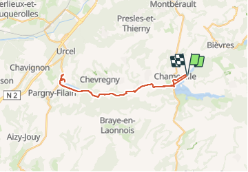
Trail Mountain bike of 25 km to be discovered at Hauts-de-France, Aisne, Chamouille. This trail is proposed by jojo02.
Positioning
Country:
France
Region :
Hauts-de-France
Department/Province :
Aisne
Municipality :
Chamouille
Location:
Unknown
Start:(Dec)
Start:(UTM)
549216 ; 5480372 (31U) N.
Comments