


Du refuge Laval au col des Muandes, retour parles Frayères - 15 août 2021

morganee
User
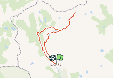

Length
16.5 km

Max alt
2833 m

Uphill gradient
847 m
Km-Effort
28 km

Min alt
2004 m

Downhill gradient
843 m
Boucle
Yes
Creation date :
2021-08-15 06:51:09.726
Updated on :
2021-08-17 14:04:49.586
6h11
Difficulty : Medium

FREE GPS app for hiking
 SityTrail
IGN / Geographical institutes
SityTrail Plus
The world is yours!
About
Trail Walking of 16.5 km to be discovered at Provence-Alpes-Côte d'Azur, Hautes-Alpes, Névache. This trail is proposed by morganee.
Description
Très belle rando, sans difficulté technique, hormis le dénivelé et la longueur, d'où le niveau moyen
Positioning
Country:
France
Region :
Provence-Alpes-Côte d'Azur
Department/Province :
Hautes-Alpes
Municipality :
Névache
Location:
Unknown
Start:(Dec)
Start:(UTM)
305390 ; 4992352 (32T) N.
Comments