


le vignemale

bellouelo46
User
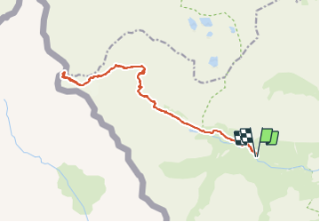

Length
21 km

Max alt
3197 m

Uphill gradient
1744 m
Km-Effort
44 km

Min alt
1679 m

Downhill gradient
1749 m
Boucle
Yes
Creation date :
2021-08-17 03:51:32.993
Updated on :
2021-08-17 16:12:05.951
10h38
Difficulty : Difficult

FREE GPS app for hiking
 SityTrail
IGN / Geographical institutes
SityTrail Plus
The world is yours!
About
Trail Walking of 21 km to be discovered at Occitania, Hautespyrenees, Gavarnie-Gèdre. This trail is proposed by bellouelo46.
Description
superbe journée il faut mettre les main pour le final et déchirer sont pantalon en descendant sur les fesses
Photos


Positioning
Country:
France
Region :
Occitania
Department/Province :
Hautespyrenees
Municipality :
Gavarnie-Gèdre
Location:
Gavarnie
Start:(Dec)
Start:(UTM)
739530 ; 4737234 (30T) N.
Comments